| Ecosystem |
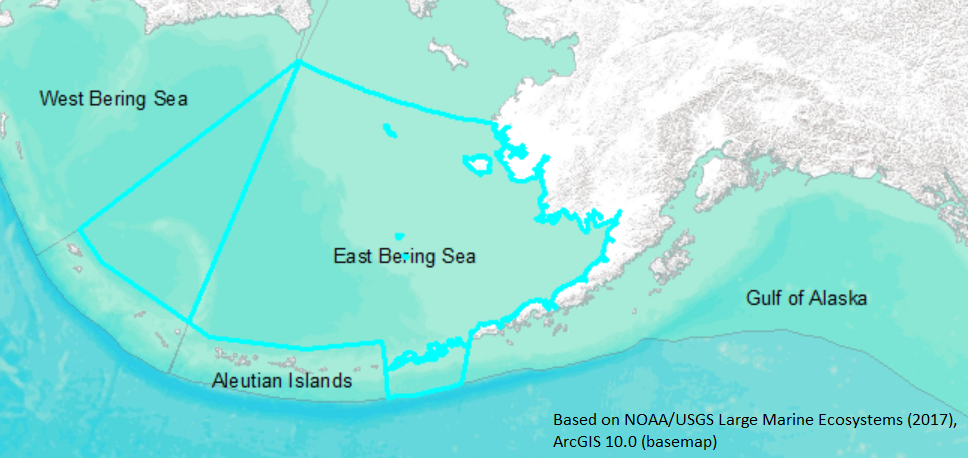
East Bering Sea |
| Type |
Sea/Bay/Gulf |
| Salinity |
saltwater |
| Other Names |
|
| Location |
|
LME SAU No 1. Alaskan EEZ portion of Bering Sea. LME2002, LME2006, SAU 2008. |
64° N 52° N - 180° W 157° W |
|
| Location Map |
East_Bering_Sea.png |
| Size Ref |
|
River Length |
|
Area |
1279388 km2 |
Drainage Area |
|
|
| Depth |
|
Average Depth |
|
Max Depth |
|
Ref |
|
|
| Temperature |
|
| Description |
The East Bering Sea has two unique physical features: its vast size and a seasonal ice cover. A "leak" at it northern boundary, the Bering Strait, has significant influence over the shelf. This shelf is the largest of the World Ocean outside the Arctic, and is bounded on the south by the Alaska Peninsula and on the north by Alaska and Siberia. It exceeds 500 km in width at its narrowest part, and subtends 11° of latitude. The shelf deepens gradually to about 170 m at the shelf break. Ice cover is seasonal, varying from none between late June and November, to greater than 80% coverage during its maximum extent in March (Niebauer, 1980; Pease, 1980). Meteorology in this region is storm dominated. General circulation can be differentiated by regions related to water depth and forcing mechanisms, and three low-frequency current regimes are present: the coastal (<50 m), the middle shelf (50 – 100 m) and the outer shelf (>100 m). (http://www.na.nmfs.gov/lme/text/lme1.htm; formerly Eastern Bering Sea) |
| Comments on faunal list |
Area from SAU (November 2015). |
| URL 1 |
http://www.seaaroundus.org/lme/1.aspx |
| URL 2 |
|
| Ecosystem Checklist Link |
|
| Total |
|
Species |
Families |
Species |
Families |
Reference |
|
870 |
313 |
|
|
|
|
